Standing at the edge of the Grand Canyon, I experienced a flood of emotions I didn’t expect. The chasm is enormous – it stretches 277 miles, runs about 1 mile deep, and an average of 10 miles across – but it seemed to signify something much more for me.
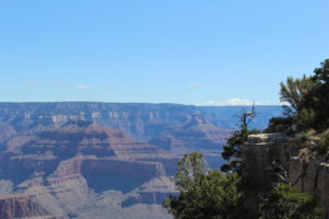 The Grand Canyon has historic significance, of course. The rocks give us a timeline about half the age of the earth. It’s also a visually appealing sight – layers and layers of color, all of which change every hour with the light and with the weather. And the Grand Canyon is an iconic place, something Teddy Roosevelt said, “You cannot improve on it. But what you can do is to keep it for your children, your children’s children, and all who come after you, as the one great sight which every American should see.” And here I was, standing on the edge of the Canyon myself.
I drove in to Grand Canyon National Park from Tucson, Arizona. At 5:00 am I’d been able to wear shorts and a short sleeve button down shirt. As I got closer to the Grand Canyon around 10:00 am, it started to snow. And I was planning on camping. Mather Campground was already full, but I was able to easily find a spot at the other end of the park in Desert View Campground.
 So, I set up my tent, in the snow, in my shorts. I did this hurriedly and even covered the tent with my extra tarp. Desert View Campground is about 26 miles from the hub of the park, including the Visitor Center. It has 50 spaces, toilets and potable water. It doesn’t have showers, though, but Mather Campground does and I was at that end of the park frequently enough that this didn’t inconvenience me. Plus, the price at Desert View was right: $12/night.
Within a quarter of a mile of the Campground, there’s the Desert View General Store, Trading Post, and Watchtower. The General Store is sizable and will take care of all of your grocery, camping, and souvenir needs. The Trading Post is a nice little snack bar and gift shop, near restrooms and the Watchtower.
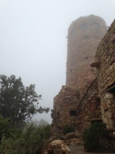
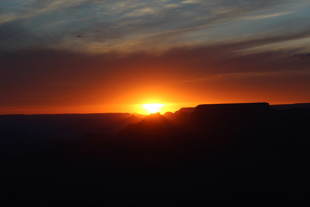
The Desert View Watchtower might be the most underrated attraction of the park. An excellent spot for both sunrise and sunset, stargazing, daytime views, and cultural interest. The Watchtower was designed by Mary Colter with Native American building practices in the forefront of mind. To be honest, it’s a bit heavy-handed, but it’s still an interesting building nonetheless. On one day I visited, two Hopi men were demonstrating their crafts. One was a metalsmith and his jewelry was simple, elegant, but also detailed and interesting. Another made spinning tops. Now, I never thought I could stand around for 15 minutes and learn about spinning tops, but this guy puts some serious thought, work and creativity into his craft. For example, one top he called the “Purple Top.” To look at it sitting still, there was no purple on it anywhere. But he used a color wheel to choose the colors he painted it so that when it spun, they all blended together to create a purple hue. I love to learn about the process of how things like this are made!
So, if you can be in Grand Canyon National Park, don’t skip Desert View. And be sure to plan one sunrise and one late night, for a sunset and then some stargazing. Bring blankets and warm drinks – the snack bar closes at 7:00 pm.
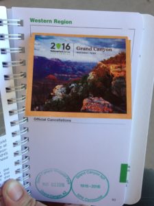 Since my first few days at the Grand Canyon were chilly, I did a lot of the indoor activities and driving sightseeing in days one and two. A stop at the Visitor Center is necessary – check out the 20 minute video on the Park, look at the educational exhibits, and watch the 8 minute video – projected onto a globe – about how the Grand Canyon was formed. Don’t forget to get your National Park Passport stamped here! This is a new project I’m geeking out about: getting my little booklet stamped at all the national parks I visit.
Across the plaza, there’s an excellent bookstore. Stop in here for resources, postcards and a water bottle if you didn’t bring one. The National Park System has stopped selling bottled water in order to cut down on plastic waste. So, in lieu of bottled water, there are lots of reusable bottles for sale and spring water at nearly every conceivable spot throughout the park. While I applaud the NPS for taking a huge stride in cutting back bottled water waste, this move actually created a Catch-22. When I forgot my reusable water bottle a few times, in the five days I was at the Park, I still needed water. I was left with the choice to buy an empty reusable bottle I definitely didn’t need one more of or resort to buying and drinking another bottled drink which hasn’t been banned in the NPS. So I actually had sodas and juices a few times I would have preferred to buy water just because my brain wouldn’t let me buy another plastic bottle I didn’t need! Bottom line: don’t forget your reusable bottle.
Also at the Visitor Center is Mather Point, an excellent spot from which to get your Grand Canyon fix. It’s not the best view in the park (more on that later) nor the best for sunrises or sunsets (see Desert View above), but it’s still terribly impressive. With a view that stretches one or more miles in any direction, Mather Point is gasp-worthy.
If you need a coffee fix, like I always do, or want to rent a bicycle or take a bicycle tour while you’re in the Grand Canyon, check out Bright Angel Bicycle Rental & Café, near the Visitor Center and Bookstore. These folks are friendly, knowledgeable, and have plenty of caffeine and bicycles to go around.
I hate to send you outside of the park, but there’s a must-see spot a few miles south of the Park entrance. And that’s the National Geographic Grand Canyon Visitor Center. There’s a gift shop and a Pizza Hut, several retailers for Jeep rides, plane rides, etc., but the thing not to miss is the Grand Canyon IMAX movie. I just find the IMAX experience to always be superb and this one doesn’t disappoint. On a rainy day, or even on a terribly sunny one, head to the Nat Geo IMAX and treat yourself.
The Grand Canyon offers a lot of driving opportunities, some bicycling, and lots of hiking. Since I went in the shoulder season, I didn’t have to combat too much traffic or people. In fact, I could easily find parking and hopped on shuttle buses as they arrived. One park staffer told me, though, that in the height of summer, there’s zero parking to be found and you can easily wait for two or three buses to fill and leave before it’s your turn.
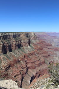 Still, I wanted to hike and be outdoors, especially once the weather warmed up. So the first chance I got, I hiked 10.5 miles of the Rim Trail. I took the Green and then the Red Shuttles out to Hermit’s Rest. This place has a huge fireplace, bigger than a NYC apartment, a small gift shop and a snack bar. It’s a nice spot to start a hike, by filling up water bottles and using the restrooms.
From there, some parts of the Rim Trail are paved, some are unpaved and rocky, and in a few places you have a choice. A few times I chose the unpaved option, to be closer to the Rim and the views. Other times, I chose the paved path because I enjoyed thinking (nearly meditating) without having to stumble over rocks and watch my head for branches.
The Rim Trail is a long hike, but not strenuous. Bring water, sunscreen, and layers, depending on the season. The hike will take you past 13+ looksouts. Each are worth a stop and photos.
It was also a wonderful treat to arrive, 4/5 of the way to the end, at the Village and treat myself to an ice cream cone and hot dog (ice cream first!) at the Bright Angel Fountain. From there, it’s a populated and paved walk back to Mather Point. One could continue on a few more miles, to the South Kaibab Trailhead, but I’d parked my car at Mather, so I called it done at that point.
You would think this hike wouldn’t take too long, but in stopping for photos, it took me about four hours. I should have brought a book or my diary, now that I think of it, since there are plenty of lookouts and benches along the way.
The Rim Trail passes through the Village and there’s plenty going on there. I actually didn’t exhaust the dining opportunities, such as the Yavapai Lodge restaurant, coffee shop or tavern, nor the El Tovar Dining Room and Lodge, nor the Bright Angel or Maswik facilities. Really, the Grand Canyon offers a plethora of dining options if you have the time or interest.
I did stop into the Lookout Studio, the Kolb Studio, Verkamp’s Visito Center, and the Hopi House. Check out all of them for their interesting architectural design, but definitely stop into the Kolb Studio. The Kolb brothers were early Grand Canyon adventurers and entrepreneurs. They were also photographers and went to daring efforts to get early, amazing Grand Canyon photos and even the first Colorado River boat run on film (movie)!
It was in the Village that I ran into another road tripper whom I met in Big Bend National Park several weeks prior. What a coincidence! Apparently, everyone passes through the Grand Canyon at some point.
Earlier in this post, I mentioned the best view in the Grand Canyon. In my opinion, that can be found at the Yavapai Museum of Geology. You actually won’t get the view from even ten feet on either side of the building, but inside, with a broad array of windows, I found the view that truly left me stunned. What a mysterious and beautiful earth we live on.
Another Museum to be sure to visit is the Tusayan Museum and Ruins. It can be a short visit if you’d like, but the information on the people native to this region, as well as surviving ruins of a home/building/community are quite informative and fascinating.
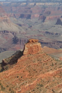 Back outdoors, I decided to dip into the Canyon a little bit. I took the South Kaibab Trail about a mile down to the “Ooh Aah” Point. Yes, it’s called that! The hike down was not too strenuous, although it did seem to strain some people’s knees and I saw a few younger folks slip in the dirt with insufficient shoes. The hike back up is what will get you, by either the incline or the thin air, so remember that as you’re cruising down those Canyon walls. Once at the Ooh Aah Point, though, it’s really wonderful and worth the minor 1.5-2 hours round trip. Step out onto the rocks for a picture, but be careful out there.
There’s plenty of bicycling opportunities in the park, although I’d advise against bicycling the roads in high traffic. The roads are narrow and people/drivers tend to get distracted in National Parks. Instead, stick to the various branches of the Greenway Trail, visiting Mather Point, Yaki Point, the Market Plaza and even riding 5+ miles into Tusayan. Or bicycle out to Hermit’s Rest, which is closed off to vehicles, except for, I think, Park staff and shuttle buses.
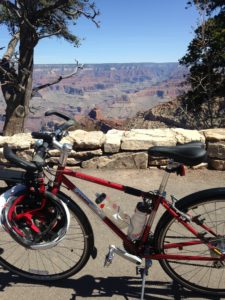 Important note: It seems like bus drivers are told to NOT pass bicycles, so you have to stop your bike and get off the road before they’ll go by. Keep your ears open then.
When not enjoying all of these activities, I huddled around the Market Plaza area, where there’s a solid coffee shop, dining room, post office, general store and a café/deli. The general store is actually bigger than my own Co-Op at home, which surprised me! But two things are worth noting regarding this plaza: the food here wasn’t so tasty – stick to the salad bar for bang for your buck – and the wifi was terribly unreliable. I’m working from this road trip, so wifi is crucial. The National Parks aren’t making this easy, although I guess I don’t want to see a bunch of office drones “checking in” and avoiding the grand views either.
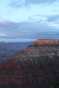 I’m glad to report that the views, hiking, bicycling, and educational exhibits won out over the wifi connection many times in my five- day visit to the Grand Canyon. This place is profound, although I’m learning that all of our National Parks are formed around profound places, each terribly unique in their own way. But the Grand Canyon qualifies as a bit of a pilgrimage in the national park system. I hope this write-up helps you navigate your time there.


2 Comments for “At the edge of the Grand Canyon”
Rachel
says:Love the long form narrative on this park! It’s at the top of my list. When it’s closer on the horizon, I will definitely come back to this post for ideas. I find that individual experiences like this are much more helpful than trying to navigate NPS’s website.
<3 from 309!
Michelle Barber
says:Glad you enjoyed this, Rachel! Yeah, the NPS websites aren’t always so user-friendly. They should hire me! 🙂 I’ve found that not all of your hiking opportunities are listed on their websites and the maps aren’t always to scale or marked out for mileage. So when thinking about hiking, dining, or just strolling, you have to pick up materials the moment you arrive or scour the internet for resources. Let me know if you head out here and I’ll send you some more tips!